On Day 3 (Tuesday, 16 October), we visited two sites: the Corresillas Conglomerate and the Alba Syncline.
To put this in context: yesterday (Day 2), we visited the Picos de Europa Mountains: thick sheets of limestone that formed late in the Variscan Orogeny. As Laurentia and Gondwana collided in the Carboniferous, they produced deep foreland basins surrounding the main collision zone. Those foreland basins filled with seawater and precipitated limestones. Later, the whole Iberian area was rotated 90-degrees, and compression came from what is now N-S. This was an event called oroclinal bending, and it thrust the foreland limestones up onto the Gondwana continent, forming the Picos de Europa Mountains.
Today, we visited two sites that formed earlier during the Variscan and were later modified by the oroclinal bending event. First, we visited the Corresillas Conglomerate, which formed from debris shed from Variscan mountains. The Corresillas was later fractured and tilted by the oroclinal bending event. Then, we took a long hike through the Alba Syncline, a sequence of Paleozoic rocks that was folded during the Variscan Orogeny, and later tilted by the oroclinal bending event.
Taken together, we are continuing to see evidence of how the Variscan Orogeny and later oroclinal bending affected the rocks of Gondwana’s foreland basin.
The Corresillas Conglomerate

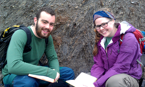
Professor Don Barber discusses conglomerate processes with Jenna Meyers (BMC '14) and Chloe Weeks (BMC '13)
The Corresillas Conglomerate formed during the upper Stephanian (a time period of the Carboniferous), ~305 million years ago. The Variscan Orogeny had already been going on for ~80 million years, and had produced high mountains to the west. The mountains shed debris into surrounding flood plains (often just basins between thrust sheets). There, powerful rivers moved cobbles and boulders long distances, forming the Corresillas Conglomerate.
We know this conglomerate formed close to its source materials. It is poorly sorted (grain sizes range from tens of centimeters to submillimeter), and many of the clasts are limestone (which cannot be transported long distances without dissolving). The well-rounded, well-cemented nature of the clasts suggests a river transport environment, and, because many of the clasts are sandstone, limestones, and crinoid-rich Devonian sandstones, we know that the source rocks were deposited in marine environments (e.g., the passive margin of Gondwana).

Fern Beetle-Moorcroft (HC '14) shows a conglomerate clast that has been fractured during the oroclinal bending event.
The conglomerate is interbedded with a non-conglomerate layer: a well-sorted red siltstone. It’s likely that the river that deposited the conglomerate migrated back and forth across the Carboniferous flood plain. When the river was elsewhere, our area saw deposition of the fine silt material. The red color tells us this is a terrestrial environment: the iron in the sediments was oxidized prior to deposition.
We also observed interesting tectonic information in the Corresillas Conglomerate. Many of the clasts were fractured in parallel cracks. Cracks were parallel to each other across the whole bed, showing that the entire conglomerate had undergone the stress, not individual clasts prior to deposition. The fractures likely formed during the oroclinal bending event at the end of the Variscan orogeny: the same event that tilted the conglomerate beds steeply to the south.
This conglomerate reinforced the story we saw in the Picos: a Carboniferous orogeny building high mountains (that then eroded), followed by a later tectonic event that tilted and fractured the foreland.
The Alba Syncline
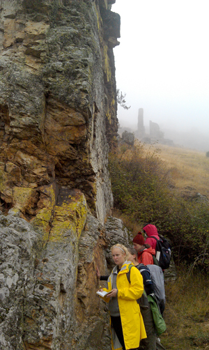
We observed the Alba Syncline during a long hike through Los Calderones Gorge, starting at Piedrasecha Village.

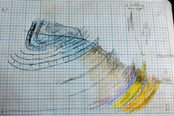
Z folds in the Alba Syncline, produced by Erin Kennedy (BMC '13), Danyelle Phillips (BMC '14), Ilena Pegan (BMC '15), Sarah Glass (HC '14), and Gabi Gutierrez-Alonso.
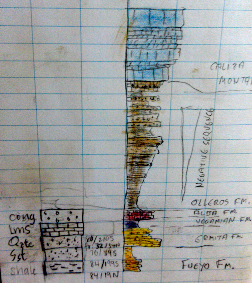
Starting in the south limb of the fold and working inward (northward), we observed:
- Devonian-age interbedded black shales and Fe-rich sandstones, with tight, angular parasitic Z folds. The black color of the shales indicated an anoxic deep marine environment, possibly on the continental shelf of Gondwana. The Variscan orogeny was just beginning to the west, and the resulting lithospheric loading might have deepened the continental margin to produce these shales. Bedding was near-vertical, indicating the hinge of the fold was far away.
-
The Ermita Quartzite: An extremely resistant quartzite showing good up-section indicators (cross-bedding). This quartzite likely formed along the margin of Gondwana as the Armorica Quartzite, but was reworked and redeposited during the collision. Bedding was still near-vertical, indicating the hinge of the fold is still far away.
- The Alba Formation at the Devonian-Carboniferous boundary: Devonian-age quartzite, followed by a fissile black shale layer (the boundary), followed by Carboniferous red nodular limestone and parasitically-folded shales. Bedding begins to shallow.
- Z-folds and Chevron folds in Carboniferous sandstones. The fine bedding allows for more flexural slip, allowing Z-folds to form.
- Near-vertical limestone beds, showing that the hinge of the fold is tilted south, presumably by the late Variscan oroclinal bending event.
The Alba Syncline records the whole time span of the Variscan Orogeny: from deepening of the continental margin off Gondwana that produced deep-water shales, to the reworking of the Armorican Quartzite, to the folding and deformation of the Gondwana foreland in the collision, to the rotation and tilting of the whole area during oroclinal bending at the end of the Variscan.
An Epic Coal Mine
Mid-way to the Alba Syncline, we drove through a vast open pit coal mine. The coal formed in the deep inland basins that developed during the collision between Laurentia and Gondwana: the Variscan Orogeny of the Carboniferous.


