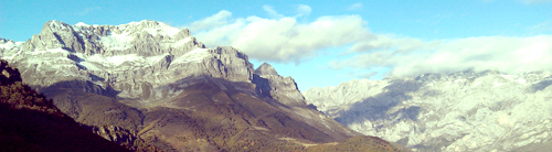
On Day #2 (Monday, 15 October), we hiked through the Picos de Europa Mountains: a thick stack of carbonate rocks that were complexly thrusted during the Variscan Orogeny.

Picos de Europa: The Geologic Story
The Picos carbonates formed during the Laurentia-Gondwana collision that produced the Pangaea supercontinent about ~390 million years ago.
The collision built huge mountains, which weighed heavily on the underlying lithosphere. The weight of the mountains pulled the surrounding crust downward, like a bowling ball sitting on a blanket. This produced basins surrounding the collision zone – called foreland basins.
The foreland basins were extremely deep, and filled quickly with seawater. Carbonate rocks precipitated out of this seawater, filling the foreland basins with the Picos limestone.
But the Variscan Orogeny was still going on – the area was still being compressed. So, no sooner did the Picos carbonates form than they were being compressed by the ongoing orogeny to the west. The Picos carbonates were thrusted eastward to accommodate the ongoing continental collision:

Compression was huge: the carbonates originally extended 150 km along the Gondwana margin – now they extend 15 km.
Around 300-290 million years ago, something changed in the Variscan Orogeny. The rocks of Northwest Spain rotated 90 degrees, and thrusting continued perpendicular to the original direction. This produced a complex thrust pattern in the Picos limestones:

But why did Northwest Spain suddenly rotate, at the end of the Variscan? Several researchers have proposed explanations.
Field trip leaders Arlo Weil (Bryn Mawr Geology Chair) and Gabriel Gutierrez-Alonso co-authored a Nature-Geosciences paper, proposing that Northwest Spain might have been the apex of a bizarre tectonic regime they’ve nicknamed the Pac-Man regime. In this model, Gondwana forms a single tectonic plate, shaped like Pac-Man.

The Paleotethys Ocean in the center has a spreading center down the middle, and is subducting along the northern edge. This makes it a self-subducting plate. Spain, they propose, would be at the center of the pie, rotating and compressing as subduction occurred.
An alternative hypothesis to explain the rotation and second set of thrust faults is a peninsula. If Northwest Spain were on a peninsula, extended out beyond Gondwana, then it might have hit Laurentia (first set of thrusts, from the West), and later Baltica to the north (second set of thrusts, from the North).
Others have proposed that Northwest Spain might have suffered from wrench shear. If it was caught between the two colliding plates, it might have rolled between them like a pencil rolls between two palms that are pressing it together.
The late Variscan rotation of the Picos carbonates is one of the most interesting problems of this area – and it remains unresolved and controversial.
Today: How It Fits In
We spent the day observing many aspects of the Variscan Orogeny in the Picos de Europa Mountains.
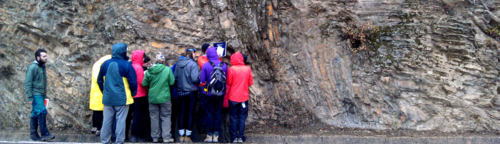
Stop #1: Syntectonic Shales, overlooking Pasado de Valdeon
At the stop overlooking the Picos Mountains and the village of Pasado de Valdeon, we saw an outcrop of black, fissile shales. We determined that these were terrestrially-deposited shales, rich in organics and iron.
These likely formed during the late stages of the Variscan Orogeny. The Picos limestones were being thrusted upward into vast mountain ranges, and shedding sediment down into neighboring basins.

Sarah Glass (H'14) points out some syntectonic shales that formed during the Variscan Orogeny in Northwest Spain.
Stop #2: Cares Gorge, near village of Cain

Cares Gorge is a long hike through the spectacular Picos carbonate thrust sheets. We observed sheets of limestone that had been thrusted to near-vertical dips, and calcites that had been transformed to dolomite by hot trapped fluids. We observed beautiful tufas: calcite that has precipitated onto a rock as groundwater flows out, allowing the carbon dioxide to degas.